How to Use This Site
This website is the product of research that Old Stratford residents have done to document objections to these housing plans.
Please use the information on this website to inform your own comments.
THE LATEST APPEAL REQUIRES OUR COMMENTS BEFORE 24 JULY 2024. PLEASE USE CASE NUMBER 3343140 WHEN SUBMITTING YOURS.
SEE OUR APPEAL WEBPAGE FOR MORE INFO.
Our Objections by Theme:
Click each title for information
WHAT'S BEING PROPOSED
JOIN US IN TAKING ACTION TO PROTECT OUR COMMUNITY
THE MAJOR FLOODING RISK
JOIN US IN TAKING ACTION TO PROTECT OUR COMMUNITY
Climate change is increasing the likelihood of heavy or intense rainfall in many parts of the UK, particularly in the winter months, which is leading to higher risks of river and surface water flooding.
The pictures here are taken from the “Check Your Long Term Flood Risk” service on Gov.UK using the nearest existing house to the proposed development as the focus point.
These images show the extent of flooding around the area proposed for new houses in Old Stratford (Planning Application No. WNS/2023/0011/MAF), as it stands today.
As can be seen from the final few pictures, the proposed attenuation pond at the bottom of the housing site (designed to capture the excess surface water of the development and discharge it into the river at a controlled rate) will be underwater during times of high flood at the present day levels of flooding.


The planners must consider the damaging effects of the attenuation pond’s water being added to high velocity flood water in the event of a flood. Not only will this increase the flood risk downstream, and particularly to Stony Stratford, but also mean that the houses at the bottom of the proposed development are at risk of being flooded.
In addition to this, planners should also be mitigating for the effects of climate change, where there is an increasing likelihood of flash floods and more extreme levels of flooding are inevitable.
Because the planned attenuation pond is in an area of the field that currently floods, if this development goes ahead, it must be moved high enough up the field to not be affected by flooding due to the extra flood risk it's water poses. It is also integral that this balancing pond is regularly maintained (which has not been mentioned in the proposal) as there are records of similar "natural drainage systems" becoming silted and causing serious issues to their local areas.


As we have ascertained above, there is a real risk of flooding.
Residents of Manorfields Road have witnessed the proposed development area flooded on several occasions, and to the extent that it becomes a flowing part of the river.
Although the planners state that the field is not part of the recognised flood plain, it does flood, as can be seen from these pictures from recent years where the floodwaters have risen beyond the gate (immediately below where the attenuation pond is proposed to be located), and on more extreme occasions (such as December 2020) well into the proposed development area, beyond the public footpath from Manorfields Road.
As can be seen from the pictures, the impact of flooding on our neighbours in Stony Stratford can be disastrous to people’s lives, so to build without due care for appropriate drainage in Old Stratford (such as putting an attenuation pond in the flood zone), could have catastrophic consequences to people’s homes and livelihoods.
UNSAFE & COSTLY HOUSING
USE CASE NUMBER 3343140
As the adjacent picture from Soilscapes shows, the soil in the proposed development area tends to be clay, which is known to retain water and have poor drainage. This is noted in the planning application, where the soakaway test soil results rated the soil as having a “practically impervious” drainage potential. It is a serious concern that these soil conditions, on top of floodplain soils that have naturally high groundwater, pose an increased risk of flooding to this development.
The proposed development is for timber framed houses in a flood risk area, therefore the construction of those houses should take extra safety precautions and have them elevated above the base flood elevation (BFE).
With the preservation order on all trees surrounding the proposed development site greenfield, it is crucial that the development plans do not disturb them in any way (from root to branch tip).
As identified in the planning application, the proposed housing construction may require the new houses to have piled foundations. If this is the case, how will the directive that they must be “well away from the influence of trees” and any “root affected clays” be managed, monitored and enforced?

Due to the flood risk, these houses may not be able to obtain insurance after they have flooded the first time. We wish for the council to put it on record that if the build being proposed floods, action can be taken against the builder and whoever gives permission. If necessary, a group of Old Stratford residents will lodge this with solicitors on behalf of whoever buys the properties.

There is undeniably a need for affordable housing and to support West Northamptonshire Council to meet its social housing needs.
However, the makeup of these houses is also an important factor.
There has been no mention of carbon reduction strategies in the construction of these dwellings. Given that we are in a climate crisis, what is the vision for sustainable construction practices and supporting residents with low-carbon living at these new properties?
Given the evident risk of flooding, as can be seen (in the photo evidence) from how high the waters have risen up the proposed development site in recent years, the houses at the bottom of the proposal are most at risk of flooding. In addition, they have gardens facing up the hill, which means that surface water would run down into the houses.
As a minimum, the proposed housing development should be moved to higher ground to prevent the risk of the houses being flooded.
However, it should also be noted that the houses proposed to back onto Manorfields Road have two important considerations that have not been tested or accounted for in the planning application. They are:
1.) Potential soil contamination in several garden plots of the proposed new houses in parallel with Manorfields Road. This consideration is as a result of the development of The Meadows on the brownfield site that was previously used as a petrol station and lorry garage, where contaminated soil was moved from there and spread in the proposed site behind the adjoining Manorfields Road gardens.
2.) There is a large drainage pipe from The Meadows down to the river that can be heard when standing at the bottom of gardens in Manorfields Road and in the adjacent field. Hearing the running water like this indicates that the drainage pipe is not far below the surface, which could affect the house and/or garden construction of the proposed new builds that are planned to run over it.
NEGATIVE IMPACT ON WILDLIFE
USE CASE NUMBER 3343140

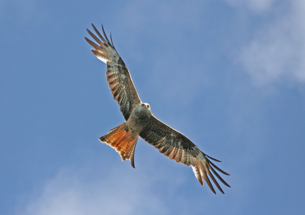
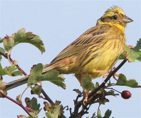
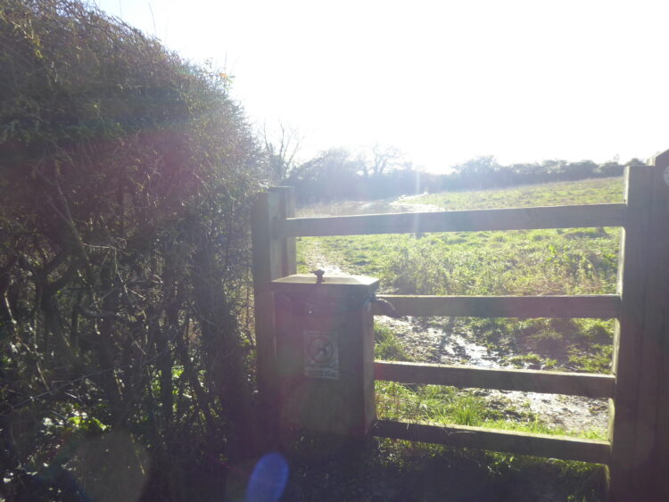
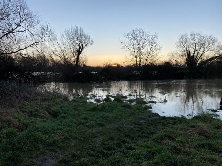
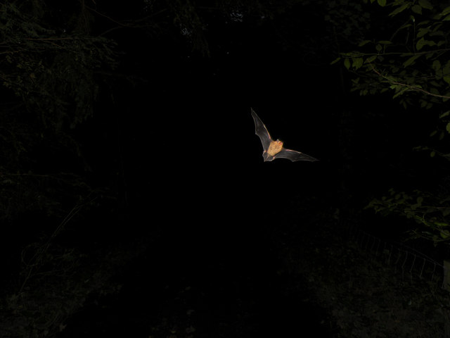
As the planning application states, bats use the proposed development area field to feed at night. Although the planner's manual bat activity survey found the site is of "low value" and "not important" for commuting bats, contrary to that, it does acknowledge the presence of one of the UK's rarest bat species, the Barbastelle; a foraging species it recognises "elevates the importance of the site".
Respecting these life-supporting creatures is important, and it should be noted that this development will cause noise, disruption, and loss of feeding ground that could be disastrous to the population.
The proposal states that bat boxes will be put up around the proposed development site, but this will not enhance a bat population that is already devastated by building works.
As per Gov.UK, it is illegal to disturb a bat colony, this includes light pollution and damaging/changing bat foraging areas, both of which this proposal would do.
The proposal's recommendation is to take mitigation measures "to ensure that the development's after dark lighting strategy is designed to minimise light spill beyond the development boundary, and to ensure the retained boundary vegetation and trees are kept unilluminated for the benefit of light averse bat species". However, this will not be sufficient as changing this greenfield landscape to an urban one with houses lit up at night will still create light pollution that recent research suggests creates a disruption to the nocturnal landscape that is a major threat to biodiversity and a concerning contributory cause to the declining bat population.
In addition, with the proposal that "external lighting is designed to be bat-friendly", would this be the case during construction as well?
As with other proposed measures to minimise damage, how will these measures be proven before committing the housing application, and if approved, how will they be monitored and assessed on an ongoing basis?


A lot of wildlife uses the proposed development area, including hobbies, kingfishers, field fares, red kites and sky larks, all of which are protected according to the Wildlife & Countryside Act 1981.
As noted in the planning application, “red-listed species of elevated concern” such as the yellowhammer, linnet, house sparrow and turtle dove have been recorded in the proposed development area. These birds are on the brink of extinction and their protection should not be ignored or overlooked.
The planning application suggests that the existing wildlife merely moves on and uses the surrounding green areas. It also says: “The potential to support species of elevated conservation concern is relatively limited, and the overall bird assemblage is unlikely to be of particular ornithological significance, and no further survey and assessment for birds is considered necessary or reasonable in the circumstances.”
However, we question this.
When we consider the ecology and natural habitat that the proposed development site provides to rare species of bat and birds, we must consider whether there are more appropriate areas to build houses that do not inflict such a negative environmental impact and mean we are failing to protect endangered species.
The proposed development will take up to 2 years, which has been confirmed by an email from Accent Housing. Obtaining a bat licence is very difficult if the disturbance to the bats is longer than 6 six months, which this development is proposed to be.
MORE CONGESTED HIGHWAYS
USE CASE NUMBER 3343140
According to the Office for National Statistics, the average number of cars per household in the UK currently, excluding London, is 1.3. Using that figure, we estimate there will be 42 vehicles for the 32 new proposed properties; which is a conservative estimate given that the proposal is for family homes and maisonettes.
According to Gov.UK, in the East Midlands 79% of people travel to work by car. Therefore based on 42 vehicles, that would mean that there could be an extra 33 vehicles on Deanshanger Road at rush hour.


Deanshanger Road is already congested at rush hour and it is difficult to drive down the road when residents are home.
It is likely that the proposed development will not have enough car parking spaces so more cars will be parked on surrounding roads.
With more cars parked on the roads, and extra vehicles using the roads, more traffic congestion is inevitably going to be caused by this housing development.
The extra vehicles from the new households, will also have a detrimental impact on the levels of pollution and noise in the area.
The extra cars will also increase the risk of road accidents.
Currently the congestion to the A5 roundabout, through the traffic lights from London Road, queues back past the Stony Stratford cricket/football club turning. This often takes more than 10 – 15 minutes for residents to get to the Deanshanger Road traffic lights during rush hour.
The RO-Land survey does not take into account the construction already being done on the V4 corridor, which is likely to impact on Old Stratford as it is the quickest route to the A5/M1.
In addition to this, there is a lorry park proposed on the other side of the A5, which could also impact greatly on the A5 roundabout, causing more traffic to divert through Old Stratford.
NOISE/ DISTURBANCE
USE CASE NUMBER 3343140
The roads surrounding the proposed development are narrow and difficult to navigate for large vehicles, making access to the site potentially hazardous and safety risk for local residents.
In addition to this, extra traffic and parking issues (including those caused by construction workers’ parking) will cause severe problems for the current residents.
The building work taking place up to 2 years, will cause construction dust and noise pollution that will be a major disruption to current residents, several of whom work from home, or are retired and also home all day.
If the recommended piled foundations are to be constructed for these new houses, what compensation will be offered to local residents from the significant noise pollution that piling is known to cause?


Our conservative estimate is that there will be 42 vehicles for the 32 proposed properties. Not only will this create parking issues and add to the traffic congestion on local roads, but the additional noise and air pollution impacts will be exacerbated by the construction vehicles and building works over the two year development period.
NEGATIVE IMPACT ON RESIDENTS
USE CASE NUMBER 3343140

Extra people on buses (for example schoolchildren) could cause extra buses to be laid on that have a route on the Deanshanger Road, causing more traffic, congestion, noise pollution and poorer air quality, especially during rush hours.

As the proposed housing development is for families and does not have any provision in the proposal for new services, it will place a strain on existing services, predominantly schools and doctors, which are already overloaded.

With surrounding local green spaces already being developed on, access to the proposed site and adjoining fields is invaluable to the health and wellbeing of Old Stratford residents, a large percentage of whom are dog owners with ever-reducing options for dog walks away from traffic.

The proposed development must not (by law) build on top of the public rights of way, even temporarily. Ordnance Survey cites three footpaths (forming a triangle) across the proposed development site.
The public footpath is used daily by local residents (Manorfields Road, London Road, Deanshanger Road etc), including those in the new developments (Dickens Drive, The Meadows & Black Horse Drive).
Our conservative estimate is that there will be 42 vehicles for the 32 proposed properties. Not only will this create parking issues and add to the traffic congestion on local roads, but the additional noise and air pollution impacts will be exacerbated by the construction vehicles and building works over the two year development period.
OVER DEVELOPMENT
USE CASE NUMBER 3343140
According to the MK Citizen on 14 June 2022, there has been over 5,000 new homes in the Milton Keynes area in the last five years. Another four estates with 3,500 homes on each, a total of 14,000, are currently being built along the V4 corridor, 25% of which is affordable housing, meaning that there will be a further 4,750 affordable new homes in the vicinity of Old Stratford.
Old Stratford uses Stony Stratford as its local centre as do the new estates on the V4 corridor, putting a significant strain on education and health resources.
The South Northamptonshire housing delivery requirement for 2011 – 2029 is 2,360 for rural areas. 1,821 of these houses were completed in rural areas between 2011 and 2018, which would mean that 539 houses still need to be built between 2018 and 2029 according to the original housing allocation target. However, the council has increased this target by an additional 377 dwellings to put the total requirement up to 916 for rural areas over that period.


As noted in item 4.2.3 of the South Northamptonshire Local Plan (Part 2, 2011 – 2029), new housing developments must meet a series of specific criteria. The Plan sets out a “Settlement Hierarchy” that development proposals must follow. In this, Old Stratford falls into the 3a “third category” as a “Secondary Service Village A”.
In view of this policy directing new developments towards the most sustainable locations in accordance with the Settlement Hierarchy, we submitted a Freedom of Information (FOI) request (pictured) to West Northamptonshire Council on 20 December 2022. 30 days later, in response to our FOI, WNC said they do not hold the detailed answers to our questions, and we were directed to raw data to find the information ourselves from here and here.
We have gone through this data, and found the following:
In theory, the total number of new houses completed in rural areas under the jurisdiction of West Northamptonshire Council from 2011 – 2021 should have results showing parishes in Settlement Hierarchy category 1 and 2 at the top. However, the two anomalies that appear to conflict with the policy are Silverstone and Old Stratford, which are both designated as Secondary Service Villages 3a category sites and have had more houses built there than several category 2 “Primary Service Villages”.


When comparing the housing allocation of all new houses developed in category 3a parishes, Old Stratford accounts for 23% of the total allocation across the 12 parishes.
If the total number of houses completed was equally distributed across all 3a parishes, there would be 65 new houses in each. However, Old Stratford has had almost three times this allocation (and Silverstone almost four times)!
Together, these two parishes (Old Stratford and Silverstone) make up 54% of the total housing allocation for category 3a. This is not proportionate, so further new housing developments should not be planned in either of these parishes.
Of the completed housing developments, we have been unable to ascertain which were greenfield sites as WNC was not able to provide any data on this when asked in our FOI.
To find out the proportion of developments made on greenfield sites, we were advised to go into every housing application to check on a case-by-case basis. This begs the question, how is WNC monitoring and managing this themselves to uphold their policy to protect greenfield land as much as possible?
Aside from the fact that this should be being monitored, it is crucial that WNC show due consideration for the significance of this proposed new development in Old Stratford being on valuable greenfield land.
We have major concerns that this proposed development is NOT in keeping with WNC Local Plan principles. We contest whether this is a fair allocation of greenfield land and satisfies the Settlement Hierarchy directive, as it is evident that a disproportionately high amount of housing developments have already been allocated to Old Stratford in recent years compared to other category 3a parishes and even to category 2 parishes.
In view of all the objections, if this development is to go ahead in spite of the serious environmental impacts, we suggest that: the attenuation pond is located further up the slope and that the number of dwellings is reduced accordingly (from 32) to mitigate the future flood risk to them. We also suggest that the development allows for low-carbon construction with a need-based appropriate allocation of "affordable housing" and resident parking (or investment in improved local transport, amenities and infrastructure), where the new streets are wide enough to accommodate large vehicles (such as those needed in the building works and for reasonable access by emergency services in future).
With this, the question remains: Is this best use of greenfield land that is a future flood risk and in a Secondary Service Village (A) that has already had significant housing development in the last few years?